
Lemoore ZIP Coverage by Area
The documented Lemoore postal geography has two principal ZIP codes. The first serves the city and a wider postal territory. The second centers on NAS Lemoore and its federal installation geography. A ZIP code directory should display both without labeling every address as a city parcel. The table gives the postal clue, then the next sections explain how to confirm jurisdiction.
| ZIP | Areas covered | Post office | Notes for a search |
|---|---|---|---|
| 93245 | City of Lemoore and postal territory beyond city limits | Lemoore Post Office, 206 C Street, Lemoore, CA 93245-9998 | Primary street-delivery ZIP; postal city does not prove municipal jurisdiction |
| 93246 | Naval Air Station Lemoore | NAS Lemoore Post Office, 826 Hancock Circle, Lemoore, CA 93246-2010 | Installation-centered federal and community geography |
No verified third unique or PO-box-only ZIP serving Lemoore was identified in the research. USPS hours listed at inspection were Monday through Friday 9 to 4:30 and Saturday 10 to 1 for the city facility, but hours can change. The exact address should be checked in the official USPS tool before a visit.
Lemoore ZIP 93245 Beyond City Limits
ZIP 93245 is the broad postal territory. It includes the incorporated City of Lemoore and can also reach unincorporated Kings County. The word “Lemoore” in a mailing line therefore does not prove that a permit, code case, voter record, or planning file belongs to Lemoore City Hall. Resolve the address with county GIS or a city boundary source after USPS confirms the route.
For each 93245 result, capture the full street line, ZIP+4 when provided, county, APN, and city or county jurisdiction. A property search may return a situs and value, while a legal description anchors title. The postal guide supplies the first sort. The parcel and jurisdiction checks supply the useful conclusion.
The Lemoore Post Office record confirms the postal facility, not a city boundary. The Kings parcel map is the better next step for land and adjacent parcels.
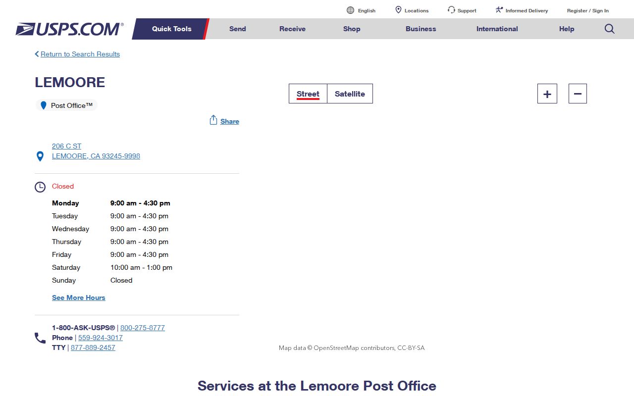
The post-office image shows the routing side of the postal directory. It should be read with, not instead of, the county parcel and city boundary sources.
Lemoore ZIP 93246 and NAS
ZIP 93246 centers on Naval Air Station Lemoore. Its mailing city uses Lemoore, but the installation is a distinct federal and community geography. A base address may not have an ordinary privately owned parcel, city permit, or civilian street-directory trail. Public records may identify official units, facilities, or historical publications without producing a comprehensive current roster of residents.
Start a 93246 search with the USPS facility record at 826 Hancock Circle and an exact-address check. Then ask which federal or county custodian owns the record type. Kings County civil records apply where a county event exists. Navy or federal records rules apply to installation material. The postal code answers routing, not access.
The split is important for family history too. A directory, newspaper, military publication, or NARA collection may identify a service connection while a current civilian property roll has no matching parcel. Record the source’s jurisdiction beside the name.
Finding Lemoore Names by ZIP
A ZIP code directory search should narrow a name trail without pretending that a ZIP is a resident list. Begin with a known surname, a verified address, or a family reason. USPS can validate a particular address. California Unclaimed Property accepts an optional city and ZIP after a required last or business name or property ID. Kings ParcelQuest starts with APN or street address, not a ZIP-wide browse. California My Voter Status has no public ZIP browse and requires the voter’s own identifiers.
- Confirm the address and ZIP through USPS Find by Address; keep the full postal line.
- Check whether the address lies inside Lemoore, unincorporated Kings County, or NAS Lemoore.
- Use the county APN or street search for property and parcel evidence, then preserve the APN.
- Use the State Controller’s name, city, and ZIP fields for an unclaimed-property lead when the purpose is family or owner research.
- Move to the correct custodian for a permit, court, voter, vital, or business record instead of treating a ZIP match as proof.
For a street-level question after the ZIP narrows the area, use the Lemoore by-street workflow. The postal guide owns the postal split; the street page owns adjacent parcels and address-keyed records.
Which Lemoore Portals Accept ZIP
ZIP-capable sources are limited. The official USPS tool resolves one address. The State Controller’s Unclaimed Property search accepts optional city and ZIP after a required name or property ID. A voter file can contain residential and mailing ZIP fields only after a requester qualifies under the Elections Code and receives an approved extract. The public Kings Assessor entry advertises APN and street address, not a ZIP-wide search. Use map navigation or a properly obtained roll extract for a group of parcels.
| USPS | Street address, city, state; returns a routing ZIP and ZIP+4 when available |
|---|---|
| Unclaimed Property | Last or business name or property ID required; city and ZIP optional |
| Assessor | APN or street address; no advertised owner-name or ZIP browse |
| My Voter Status | Private identifiers; no public ZIP browse |
| Approved voter file | Residential and mailing fields may appear for an approved purpose |
The right field matters more than the broadest search. A ZIP-only output can mix city parcels, county land, and base addresses. Add APN, jurisdiction, legal description, or an official record identifier before using the result.
Lemoore ZIP, Situs, and Legal Descriptions
Three location fields often appear together but do not mean the same thing. Situs is the physical parcel location. Mailing is the destination for tax correspondence. A legal description identifies the land through a lot, block, tract, or metes-and-bounds description. ZIP codes belong to the mailing system. The legal description and APN are the stronger bridge when an address changes or a parcel has no normal street number.
- ZIP code
- A postal routing area. It is not a city boundary and does not list every resident.
- ZIP+4
- An added delivery segment for a particular address or route.
- PO-box ZIP
- A ZIP used for postal boxes or a facility route; the research did not identify a unique third Lemoore ZIP of this type.
- Carrier route
- A delivery path within the postal system, not a parcel or legal jurisdiction.
When a search returns a mailing ZIP that differs from a situs ZIP, do not merge the fields. Ask the Assessor or county map which parcel is involved. Ask the City Clerk or Community Development whether the address lies in the incorporated city. Ask the Recorder for the controlling deed description when title is the question.
Lemoore ZIP Parcels Need APNs
Agricultural parcels can lack a conventional situs address or use a mailing line that does not describe the land. That is where the APN becomes essential. The free Kings property search may need the APN, and the weekly map can show the assessment polygon and nearby APNs. The map’s geometry is not a legal survey, and the tax owner or mailing recipient is not a complete household result.
Carry the APN into a deed request, subdivision plat, permit report, or tax question. If the street line fails, keep the old form, new form, lot, block, tract, and legal description together. Ask City Clerk or Community Development whether an annexation, subdivision, rural-route conversion, or addressing memo explains the mismatch. The research did not verify an official Lemoore-wide mass-renumbering or ZIP-realignment year.
That gap is useful information. It tells the searcher to request the underlying map or resolution instead of inventing a date. A clean postal guide distinguishes what the record confirms from what still needs a public-office answer.
Lemoore ZIP Permit Jurisdiction
Once a ZIP code points to an address, choose the permit custodian by jurisdiction. Lemoore Community Development’s paperless suite covers building permits, plan submissions, and business licenses for the city. Its January 2026 reports expose permit number, work class, status, issue date, address, zoning district, and APN. Unincorporated Kings County sites go to county departments. A NAS Lemoore address may follow federal installation rules.
The city planning and Community Development page is the city-side starting point. The postal guide should record the date of the permit report and the jurisdiction beside the address. A ZIP match alone cannot decide which office holds a file. A permit dates work at a place, but it does not prove who occupies it.
For a code complaint, Lemoore’s Police or community service officer route uses address-based categories and may require a public-records request. For parcel identity, use the county Assessor. For a deed, use the Kings Recorder counter. Three addresses that share 93245 can still have three record paths.
Privacy at the Lemoore ZIP Level
A ZIP code is too broad to establish a person’s current place, and a narrow postal result still does not open protected data. DMV addresses, utility accounts, delivery records, Safe at Home participants, confidential voters, sealed cases, and unnamed household members remain outside an ordinary ZIP search. California’s Public Records Act covers identifiable existing records, but agencies may redact exempt details and need not build a new list from separate systems.
Lawful personal use. Use ZIP information for address correction, family research, civic questions, property history, and personal safety awareness. Do not publish protected details or use a postal guide to stalk, harass, intimidate, or harm anyone.
The practical rule is simple: verify the address with USPS, the land with APN and legal description, and the person with a custodian that can lawfully answer the question. The ZIP code directory is a routing layer. It becomes reliable only when the city, county, federal, and state layers remain visible.